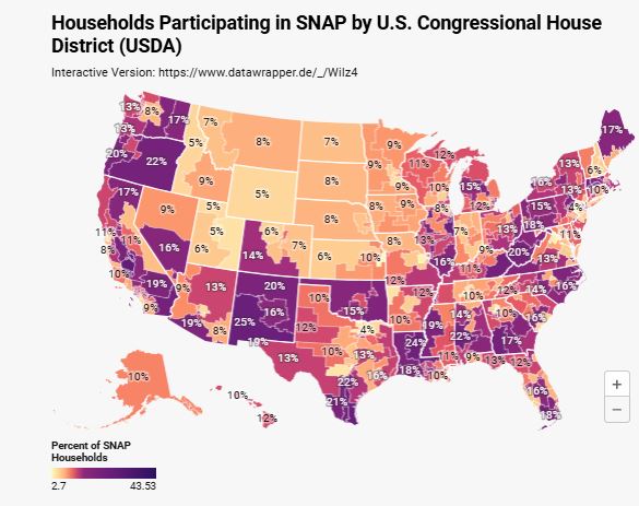
Households Receiving Food Stamps (SNAP) by Congressional District
Households Receiving Food Stamps (SNAP) by Congressional District
The goal is to turn data into information and information into insight. — Carly Fiorina
Last month we featured an infographic with a state-by-state breakdown of Americans on welfare. That being said, with all of the recent hullabaloo (and controversy) over funding for SNAP benefits during the government shutdown, the folks at Brilliant Maps put together an interactive map of households by congressional district receiving SNAP benefits (aka food stamps). Be sure to look at their complete list of all congressional districts, which can be sorted several different ways.

